Book data
Dingle Way
Sandra Bardwell Jacquetta Megarry
04 January 2023
UK price £14.99
72pp,
130 x 220mm,
155g
978-1-913817-11-4
Dingle Way
(4th ed)
£14.99
Sandra Bardwell Jacquetta Megarry
In stock
eBook options
Buy an eBook to read this guide instantly, no waiting for the post.
| UK |
Kindle Fire/HD

|
| US |
Kindle Fire/HD

|
"The indispensable guide for the Dingle Way" - Washington Times
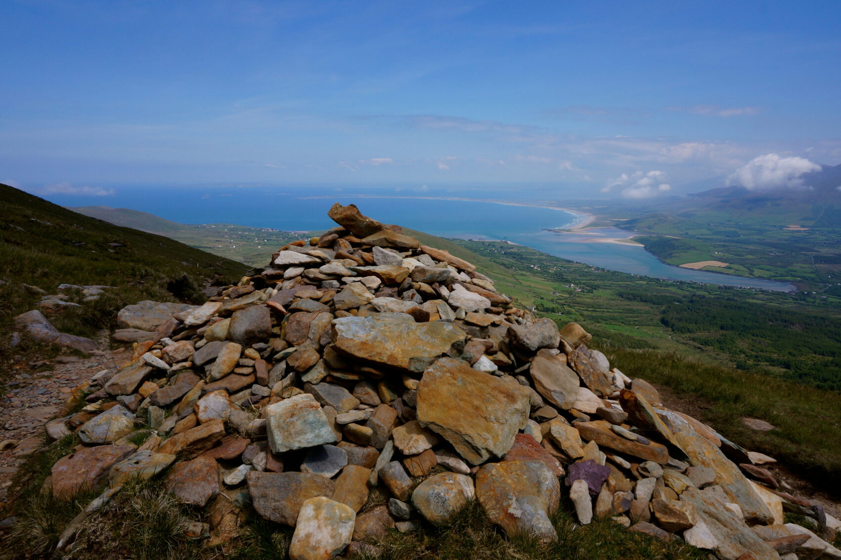
The Dingle Way runs for 114 miles (183 km) around Ireland’s beautiful Dingle Peninsula. It starts and finishes in Tralee, accessible by train or bus from Dublin and from Kerry Airport. The complete walk takes most people eight days, but it can easily be shortened.
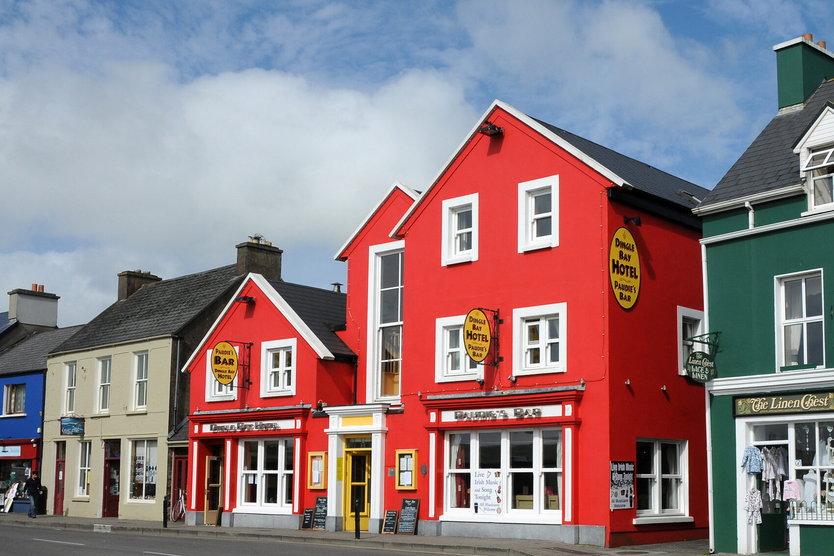
The Dingle Way follows country lanes, quiet roads and cliff-top paths, punctuated by long stretches of glorious beach walking. It offers spectacular seascapes and mountain views. The peninsula is rich in wildlife, archaeology and charming Irish pubs.
The guidebook’s fourth edition has been revised for 2023, with updated mapping showing route alterations, additional Gaelic placenames, factual updates and fresh photos. It is in our lighter, pocket-friendly rainproof format with robust perfect binding.
This contains all you need to plan and enjoy the Dingle Way:
- the Way in sections, with summaries of distance, terrain and where to find food and drink
- concise background on pre-history, heritage and wildlife
- information about climbing Mount Eagle and Mount Brandon
- special feature on the Blasket Islands
- planning information for travel by car, train, bus or plane
- detailed mapping of the Dingle Way throughout (1:55,000)
- in full colour, with 75 photographs
- on rainproof paper throughout.
Click on the thumbnails below to view sample pages from the book "Dingle Way" in standard PDF format.
To reduce loading time, resolution is limited in these extracts, but all photographs are printed at top quality in our books. All text and images are copyrighted ©Rucksack Readers and licensors: please respect our intellectual property.
 Contents
 Extract from planning (pp4-10)
 2.5 The Blasket Islands
 3.4 Dingle to Dunquin
Click thumbnail to enlarge.


From Irish Mountain Log, Autumn 2019, page 64
The user-friendly format has been improved … it is slimmer to help it better fit into a hiker’s pocket. It also now has larger-scale maps, clearly showing the current route.
The authors are very enthusiastic about the Way and seem to have a good handle on the culture of the Dingle Gaeltacht. Overall, this guide is a very comprehensive update to the previous edition and is very easy to use.
Patrick O'Sullivan, Editor
Online review on Amazon.co.uk
The detail in this book convinced us that we could actually go do the trek. We bought two other books on walks in Ireland and none of the others were nearly as good as this one for the Dingle Way. The others were more overviews. This was a very specific trail guide with precise distances, markers, turns etc.
Amazon customer (verified purchase)
From the Washington Times Special 22 July 2006
The indispensable guide for the Dingle Way … 64 water-resistant pages in a ring binder, with color photos and good maps.
Excerpt from "Footprints on Dingle" by Peter Bridges
Online review on Amazon.co.uk
Very useful guide with excellent, clear directions (in big enough type to read without my reading glasses!). Clear maps, though numbers on the contour lines and grid references are missing, so the nerd part of my character was occasionally frustrated. Interesting background info about the fauna and flora, plus history makes it more than just maps with instructions. Fold out format of maps on strong card withstood gale force winds! Good value for money.
Stephen Lustig, London
Online review on Amazon.co.uk
I bought a copy of this before hiking the Dingle Way in Ireland. It’s a good guide and I gave it to another hiker when I finished. When I got back home to the US I purchased a second copy to show friends and family the route. It has beautiful photos and background/historical information in addition to the route info.
Tracey M on Amazon.co.uk
Online review on Amazon.co.uk
Compact, informative, good maps, fits in jacket pocket and waterproof, easy to fold and unfold. It is coming with me to the Dingle peninsula this April. Nice product.
boatnut on Amazon.co.uk

GPX route file
The mapping in this book has a contour interval of 25 m (82 ft) with a change of colour every 100 m (330 ft).