
Book data
Wicklow Way
Jacquetta Megarry
18 September 2019
UK price £12.99
72pp,
8 x 130mm,
160g
978-1-898481-90-4
Wicklow Way
(3rd ed)
£12.99
In stock
eBook options
Buy an eBook to read this guide instantly, no waiting for the post.
| UK |
Kindle Fire/HD

|
| US |
Kindle Fire/HD

|
"Vital reading for anyone intending to walk all or part of the Wicklow Way" - Helen Bligh on Amazon.co.uk
The Wicklow Way is Ireland’s first and most popular Waymarked Way, running between Marlay Park (Dublin) and Clonegal, 81 miles (130 km) to the south-west. It offers varied and scenic walking on the flanks of the rugged Wicklow mountains with loughs and waterfalls, passing historic buildings and hospitable villages. Much of the route lies over 1600 feet (500 metres) giving glorious views. Lower sections run through forests and farmland, over a mixture of tracks, roads and pathways rich in wildlife.
Our third edition was released after the author rewalked the route in August 2019. It has many route updates, some never published before, 95 colour photographs and 13 pages of detailed mapping at 1:35,000. Despite having more pages (72 pp), it is lighter and more rainproof than ever.
This guidebook contains all you need to plan and enjoy the Wicklow Way:
- detailed route description, updated in 2019, with distance, terrain and food and drink
- the secrets of how to book accommodation to avoid walking extra distances
- concise background on history, geology and wildlife
- extended 6-page feature on the monastic city of Glendalough
- planning information for travel by car, train, bus or plane
- in full colour, with 95 colour photos.
- detailed route mapping on 13 pages (1:35,000)
- on rainproof paper throughout.
Click on the thumbnails below to view sample pages from the book "Wicklow Way" in standard PDF format.
To reduce loading time, resolution is limited in these extracts, but all photographs are printed at top quality in our books. All text and images are copyrighted ©Rucksack Readers and licensors: please respect our intellectual property.
 Contents
 Planning (extract)
 2.1 Glendalough
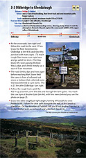 3.3 Oldbridge to Glendalough
Click thumbnail to enlarge.


Review of third edition in IML magazine, Spring 2020 page 65
This new edition is a well-written detailed guide to the Wicklow Way, section by section, each with a detailed map. The guide also gives all the advice you might need to plan your hike, and background information on places of interest, the geology and the flora and fauna.
It updates the previous editions to map the changes to the route in the last couple of years. Certainly the changes that have occurred in the section above Loch Dan down to Oldbridge are well mapped and clearly documented in this new edition.
Patrick O'Sullivan, Editor, Irish Mountain Log
Excerpt from online review
This book gives a very comprehensive description of the route and contains much relevant additional information and many fine photographs.
See www.wicklowway.com for more
Excerpt from review in "Irish Mountain Log"
This is a really excellent guide to the Wicklow Way … No-one should get lost if they follow the instructions in conjunction with the five-panel drop-down map and the waymarked signs on the ground. … It has a special extended section about Glendalough, a rather good potted history of Ireland, and sections on geology, flora and fauna. … A walker not familiar with Wicklow will certainly find everything they need there.
Review by Brian Gilsenan, IML Summer 2003, page 44
Excerpt from 5-star Amazon review
This is vital reading for anyone intending to walk all or part of the Wicklow Way … Packed full of useful, interesting and informative advice as well as essential maps and marvellous photography, the book is set out in a clear and concise manner. It can be used as either a practical guide full of helpful tips and must-know facts or just an absorbing read. This is the third Rucksack Reader I have read, and they just keep on getting better.
Helen Bligh, London at Amazon.co.uk

South to north directions

GPX file
We apologise for three small mistakes in this book:
- On the page 12 bus map, the Wexford Bus 740 route is incorrect: it doesn’t service Wicklow town, but the shorter route 740A does so.
- The mapping has a contour interval of 25 m (82 ft), with a change of colour every 100 m (330 ft).
- On page 49, Brusher Gap Hut is shown too far north: its correct position is at km 44.5, as is clear from the foot of page 47. It is now shown correctly on this page: click + on the Look inside tab to download part 3.3.
